Sunday, March 30, 2008

That would suck


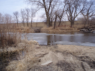
Hola amigos! We drove down to eat at Mad Mary's in Flandreau and grabbed some shots of the river for the upcoming Earth Day extravaganza. Water levels are looking good, but we were thinking how much it would suck to be paddling in the wind and cold we experienced March 29, just scouting.

Here you can see the spot proposed as the put-in, looking back at the oval-shaped parking area on the north side of the river.

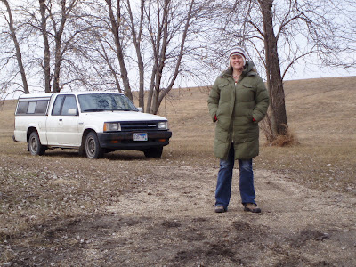
Here's a few more, first two are at the top (we can access on both sides of the river) and the last couple are at the bottom. Should be a rocking paddling trip on the BSR, ya'll!

Remember, if you want to see a full-sized version of any image (they sorta stacked up on me here!) just click on it and you'll be rewarded!)

Bieso


Friday, March 21, 2008

A Cabin in the Wild

Jarett and I discovered this cabin when we paddled across Gunflint Lake from our campsite on the Minnesota side.


We found out that the cabin had belonged to a man by the name of Charlie Cook. He was the last survivor of an Indian tribe that lived across the lake. Charlie was a medicine man. It looks like he lived without any plumbing or electricity. Very thrifty man!


When we first stopped to look at the cabin, we found lots of poison ivy and leeches in the water. There also was a big lock on the front door of the cabin. Eventually I took a peek in the house.


It appears from outside as if this man's life had been left behind, we could see old bank statements and Christmas cards on the floor and an old calender on the wall that probably had not been turned since Charlie passed away.


It was cool to see a piece of history like this. It wouldn't have been possible without the kayak as I would not have swam across the lake filled with leeches. This was an amazing adventure for me.

Peace Out!
Laura

Lake Superior

While this is a South Dakota kayaking blog, I wanted to share thoughts on my favorite kayaking trip I took with my husband. It was one of the most challenging for me. This is a photo of Meyers Beach on Lake Superior which is near Bayfield, Wis.

We set off from this little sandy beach – you can see Eagle Island behind us in the distance, and the caves are where the mainland crops out in the top right of this photo - and went to the mainland sea caves. Unfortunately on this trip we did not do a crossing from the Wisconsin shore to an island, but that's on the top of the list for next time we go.


So anyways we left from Meyers Beach with our spray skirts and the wet suits we rented from the University of Minnesota. The sea caves were about a mile up the coast from the beach. There were lots of other kayakers making this trip.


I wish I could describe the sound of the water slapping the insides of the sea caves – it was a very unusual sound. By listening you could tell the some of the caves went in pretty deep. At the time I pictured one of the waves sucking me into the cave and smashing me on the roof of the cave, but we were very careful and the lake was pretty calm that day.


The only think I didn't like about the sea caves trip was that I got a little sick on the way back. Normally I like the big waves and I find it thrilling. This got to me after awhile because I had the waves coming in from sea and also the reflective waves bouncing off the caves. Despite me getting a little sea sick I still kept on paddling.


I also wanted to include this picture as it was me paddling out in the big inland sea that is Lake Superior. It was the first time I have ever looked over the side of my boat to see the bottom of the lake 50 feet (or more!) below. I could see huge boulders under the water just like the ones sticking out of the water in this photo.


The last couple of items I wanted to include on our Lake Superior trip were from the conclusion our trip. We went up the Gunflint Trail near the Boundary Waters that separate the U.S. and Canada. One of the highlights paddling on this lake (there are hundreds up there, we were on Gunflint Lake) was the first time I've ever seen a loon.
Now I really do understand where loony comes from :-) There's a loon in the picture behind me.

Last thing to share was this shot of me reaching out to touch Canada. The folks at the lodge seemed surprised that the Border Patrol didn't get after us for crossing into the Great White North. But were were pretty much out in the middle of nowhere and it's not like I would abandon my boat out in the woods to make a new life in Ontario.


Lake Superior and northeastern Minnesota were a blast. There's a lot more things I wanted to do while we were there but we went full speed for the week we spent and got a lot done. But we saved a few things for the next trip. I can't thank my wonderful husband enough for being my guide on this awesome adventure. Love you Babe!!

Laura

Thursday, March 20, 2008

Missouri River trip upcoming


When we paddled High Lines to Clay County last summer, it seemed to fly by, in part because the river is massive.

But at times it was puny.

We got hung up on sandbars in a few spots where it was ankle deep.

There's a lot more spots where current was strong, and the water deep.

The route planned for the May 10 cruise is a great one. With the water levels up a bit and plenty of people, we should be able to steer clear of the shallow spots and just float on down.

There are lots of islands and there should be plenty of birds. The first part does go through some cabin/dock areas, but there are plenty of wilder spots as well.

Regardless of the water level, the route does go through areas where scientists have been attempting to reintroduce osprey, so here's to hoping we'll see one, and some eagles to boot.

For paddlers new to the Missouri, this cruise is about as good a place to try it as any, plus it's free. So e-mail us if you have questions.

If you're wondering, Laura didn't dump it in the picture above, she's too good.

This photo's been posted before, but it's worth one more upload. You have to try it, as it is an amazing feeling, being on water that big, it's a hoot!


Jarett

Tuesday, March 18, 2008

Scoop on Earth Day cruise

Bienvenidos, amigas, amigos:

A bit of news, and I'm posting it here first so if I have mistakes I can fix 'em in the SDCA blog. I'll try to avoid cross-posting in the future as well.

After much planning and route reconnaissance, the first-ever South Dakota Canoe Association Earth Day cruise is cooking with gas.

We invite all paddlers to join us at 11 a.m. Saturday, April 19, 2008, at the parking area on Highway 13, along the Big Sioux River, one mile north of Flandreau, for the 2008 Earth Day event.

For the last three years, the East River Sierra Club has hosted this event. Now the SDCA is hosting it, in collaboration with Sierra Club and the Outdoor Women of South Dakota.

This cruise should rock.

Here's a close up of the put-in spot:


Highway 13 is that dominant vertical line, it runs north and south. You can see that after it crosses the river, there's a race-track looking parking lot on the west (left) side of the road. That will be the staging grounds for the event. Obviously, the put-in is the southern most point in the lot.

The Sierra Club will have a San-O-Let there, plus the Sierra Club will have a bus to shuttle people from the bottom back to their cars. Those services are locked solidly into place. The cost for the paddle is $10 to cover these service costs.

The SDCA never charges for events. So, members will shuttle vehicles to the Flandreau City Park, which is where the cruise ends. Between the bus and the shuttles, everyone should enjoy a nice, easy paddle down to their car.

But no one has to pay to paddle this trip. But if you want to use the bus, you should pay $10.

The aforementioned park looks like this:


If you look at the top of the image, you can see the river running along the top of the park and all those white lines on the water are spots to take out. If the water levels are high (we'll know soon) and the cruise seems too short, there's another take-out down river before a dam. But this is the official take-out spot. (More intel on the other spot coming.)

Overall, the route is about eight miles. It should take most paddlers two to three hours to complete. It will be April 19, so it could be quite cool and windy, and the water temperature will be low, so everyone should be careful, pack spare clothes, and take it easy. Have fun, appreciate nature, but don't get cocky or you'll end up soaked and shaking as we call the ambulance. Speaking of which, the Sierra Club wants waivers for all paying participants.

The park offers bathrooms and plenty of space. With sun and mild temps, it might be a nice place for an impromptu barbecue. In the past, the Sierra Club has encouraged folks to bring their own brats and such and cook out after the day on the river. We'll pry have the place to ourselves, so stick around if you're so inclined.

The Sierra Club does request registration for paddlers, esp. if they are planning on using the bus service. To register, e-mail Deb McIntyre at peaceandjustice@svtv.com or e-mail me and I will fwd your info to her. Since the bus and San-O-let are the only cost factors, she sure hopes people will sign up in advance so we can get that wrangled.

This is a new route for the Earth Day operation - in the past, the Big Sioux has been kind to paddlers traveling from Trent to Dell Rapids, the first two years, and then again from Egan back to Trent, which was last year's route. This year might put some paddlers in touch with river otters, which are in the BSR, but good luck as they are not gonna paddle up and open a shell next to your cockpit.

Having a cruise in April gets many of us out for the first time of the season, and that makes it a good thing, so we're hoping to shatter past attendance records. The nice thing about this route is we're really never far from Flandreau, so if someone does tip over and end up soaked, we'll have plenty of back-up.

OK, mates, Target No. 1 is identified. Come back here when you can because as the weather allows, real-deal scouting will follow. Here's an "overview" image of the route. Mapquest "Flandreau, S.D." and you can switch to aerial view and zoom in and out to your heart's content, fyi.


Peace,
Bies, J.C.

Thursday, March 13, 2008

Plan now, thank self later


Howdy-howdy, we're back - sorry, to our few visitors, we do apologize for the scant blogging lately - but it is March after all and NE Sodak is ice, but soon. And we're back with some chat about planning operations, on why now is a good time to get cracking.

The main reason to start planning now is that the rivers of South Dakota only rock for a short time in the spring. Not all, naturally, but the ones out west are typically no fun if you go too late, or between rains.

That's why I have to recommend immediate recon operations on the Net about the Cheyenne River. I wrote a news story about it a while back, and everything I wrote made me want to go. I'm still obsessed with it, 'cause I haven't gone out there yet, but I had these photos to share, they were were taken on the Cheyenne.

Main reason I haven't gone is because I think of it in February and then get side-tracked and end up thinking about again around the Fourth and the hit-miss water levels that late in the summer are dicey for a drive that far.

Caleb Gilkerson took most of the photos. He's a friend of mine, he owns Steamboat, Inc., in Pierre. They do guided day tours, dam runs, multi-day tours - the whole schmear. If the idea of driving with a boat all the way out to NW South Dakota to find a good put-in on your own sounds like a chunk of time too big to bite down on, Google his business. They have all their information on the W.

When I interviewed Caleb, he said more people summit Everest than paddle the Cheyenne River in any given year. I thought that was a pretty cool quote. Some could say "Well, yes, but ... " but if they did I would just say look at the pictures. When I do, I just go, wow, this isn't my Sodak. I could plunge into this time warp world without leaving the state? Sign me up.


Sure, in some ways, you are just out in the middle of Western Sodak, in cattle country, not like some enchanted prairie, but it's an away. A trip like that seems so tempting. Plus loud coyotes at night, rattlesnake population, star gazing galore in true darkness ... an away to dream about or wish for.

Population density so low. Wilderness. Out in an ocean of ranch.

My original point was this: Today is 13 March, and with the snow melt on the way, the Cheyenne should be dandy until at least June. So we should all start planning trips there, and elsewhere, before we end up booked with nonsense until late summer water levels make it a lot less fun than it could be. Of course, USGS.gov helps.

Maybe not all at the same time, same place, but here's to hoping everyone who reads this gets to paddle West River this summer - one new lake, one big river, or one fun trip worthy of writing a story about.

(For our West River readers, love, you are welcome to come east, because in sections, the Big Sioux River is darling and lush.)

Peace!

Bies

If anyone goes west, please post and share, or if you know the Cheyenne River let us know!

Cheers,

Jarett and Laura

Tuesday, March 4, 2008

Want to paddle!!

I'm ready for winter to be over and to start paddling now! As we start the countdown to spring (16 days from today) We are maping out a list of water we would like to paddle. There are so many lakes close to our house that have yet to be explored. One of the places I'm most excited to see is Big Stone Lake... For more info on that see the website: http://www.sdgfp.info/Parks/Regions/GlacialLakes/BigStone.htm

Let me know if you have paddled that lake or if you have recommendations around the Brookings area.

Tell then... ta-ta!
Laura

So what do you paddle?

We added a photo to the blog today that shows (most) of our boats and we thought it would be a good topic to blog on about.

My boat is a QCC fiberglass kayak. It's about 17 feet long and weighs about 60 pounds empty. It's a "freighter" of a sea kayak, with lots of room for storage and for a paddler who weighs more than 200 pounds. I named it Slippery 2 as my cat, who is also white with black trim, her name is Slippery.
I bought the boat through the QCC folks on the phone. They do not sell retail, only factory direct. Fiberglass is the "bottom end" as they do a lot of those super-spendy kevlar and carbon fiber boats.
I have a rudder on my boat, but I try to avoid using it so I can master hip steering.

Laura's kayak is a Perception roto-molded sea kayak. It's a 15-footer and weighs a little less than mine. We wanted to avoid getting her a boat so short we'd have trouble sticking together on longer trips. Having paddled them both, Penelope, as Laura calls hers, has no trouble with speed. Plus she's sturdy, not tippy at all, and takes a spray skirt with aplomb. It has a skeg, but we're considering adjusting it as it doesn't seem to descend much when deployed. We're still trying to decide if that skeg helps much. And our soft-side cooler fits nicely in the back hatch!

What do you paddle? We found Laura's boat at a Sioux Falls, S.D., retailer, and the price was right, but here in Flatland USA, we're curious as to who paddles what boats and where they got 'em.

Holler!

Jarett

Monday, March 3, 2008

We're live in Elkton!

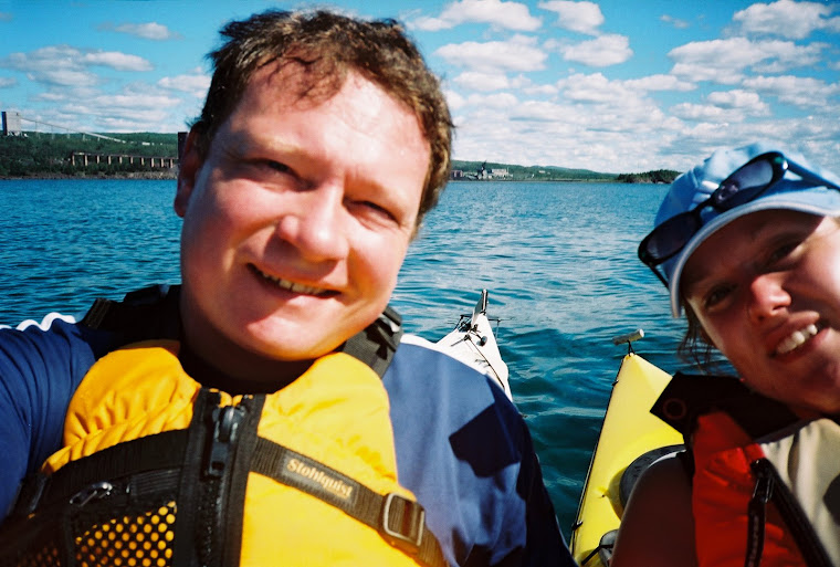
But the photo is from Duluth! Wha?

Hi Friends!

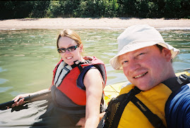
We're two crazy kids with kayaks. Our mission is simple: paddle and share the stories. We'll be back with more crazy paddling stories and photos. Feel free to share ideas, lakes, rivers, etc. We'll take them.

Look for more posts soon!

Jarett & Laura